![]()
![]()
![]()
Activities for stage 2
Visit by NT land resource assesment staff to West Timor. Lecture on technology for land resource assesment at Nusa Cenda Univeristy in Kupang. |
 |
In-country GIS training in the integration of land resource field data into GIS and the use of GIS for identifying opportunities for rural development, land rehabilitation and resource conservation, and potential environmental and economic risks associated with proposed developments.
GIS Forum to share experiences of applications of GIS in Ngada/Nagekeo, TTS and East Sumba with neighbouring Kabupatens (Manggarai, TTU, Kupang, West Sumba)
Work attachments with NT Government staff for four Indonesian staff to learn field skills in land resource assessment. The primary activity will be participation in NT Government land resource field surveys.
Community agroforestry training at Ngada/Nagekeo in systems for community-driven agroforestry and microfinance, and institutional capacity building.
Community agroforestry and fire management forum to discuss experiences of community-based development enterprises and fire as a management tool.
In-country burning training at key village communities in Nagekeo, East Sumba and TTS in safe, effective controlled burning methods.
The following are detailed descriptions and photos from Stage 1 activities:
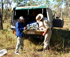
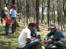
Cross Visits to field sites. (24th September - 2nd October)
NTT government officers from of E. Sumba, Flores and W. Timor visited field sites where rural development programs are underway, including ACIAR fire project sites and NGO study sites. |
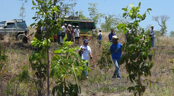 |
The ongoing development of agroforestry in combination with proactive fire management techniques on extensive savanna grasslands where shown at villages in East Sumba and Ngada regency(Flores). These sites began as a joint project between the Australian government and local Indonesian government and NGO's and have been successfully expanded and used as a demonstration site for surrounding communities.
The field trip was an opportunity for NGO/government staff and local villagers to share experiences in rural development activities at each site. Strengths and weaknesses where discussed and opportunities for future work identified.
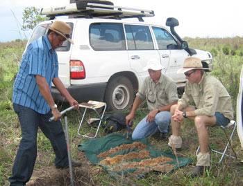
In South Central West Timor regency projects in animal husbandry and small scale irrigation projects where presented to the group and the potential utility of fire management and and agroforestry techniques in the regency discussed.
Click here to see more photos from the visit.
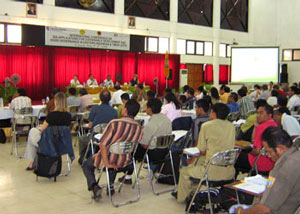
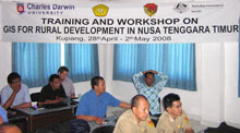
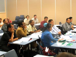
GIS and Remote Sensing workshop Kupang (10-15th July)
A six day intensive GIS and Remote sensing workshop was held in Kupang for fourteen BAPPEDA officers from Sumba, Flores, TTS West Timor, the provincial office and and staff from Satya Wacana University, Salatiga. |
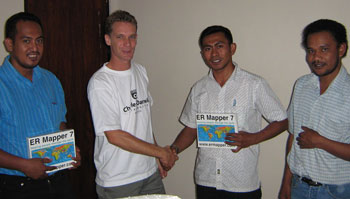 Agus (Sumba), Efraim (Flores) and John (TTS) receive ERMapper Licenses from Rohan FIsher (CDU). |
Training was conducted by Rohan Fisher from CDU with assistance from Erlin Bobanara, from Flores, and Agus Rawanbuka from East Sumba. Additional logistic support was provided by BAPPEDA NTT. The six day training program provided an introduction to using Satellite Image analysis software for land resource mapping and monitoring and the use of Geographic Information System software for map making and spatial analysis.
Training included the development of data sets derived from satellite imagery and their subsequent inclusion in a GIS analysis of land development suitability. All data sets in the examples used imagery and vector data from East Sumba.
The tutorial examples were provided to each participant in the form of a CD-Rom with satellite and GIS data and screen video of all the software processes as covered in the training. Further bilingual development of this product will be conducted by Satya Wacana University and new versions will be distributed to all participants. Text books for GIS were also provided. It is intended that these material will enable participants to continue to learn in their own time.
The workshop also provided an opportunity for net-working and discussion between participants about coordinating their strategic plans for GIS development and application in NTT.
Click here to see more photos from the workshop.
Study tour by senior Indonesian land managers (6-10th June)
| Connections were strengthened between the Northern Territory and senior land managers in eastern Indonesia through a highly successful study tour to Darwin. | 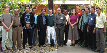 |
A group of ten senior government officers from eastern Indonesia visited Darwin to increase eastern Indonesia’s capacity in the areas of land use monitoring, and planning and implementation of sustainable land management practices.
The study tour included valuable interactions with NT Government officers and researchers at CDU, Tropical Savannas Management CRC and CSIRO, through seminars, discussions, demonstrations and a field visit. The program was organised by EHS’s Rohan Fisher, Guy Boggs, Bronwyn Myers and Umi Rasmi, and NT Government’s Andrew Edwards. Our Indonesian visitors learnt about the mapping and GIS tools, and methods for land use monitoring that are used in northern Australia, often remarking on the similarities in environment and issues for eastern Indonesia and northern Australia. There was much discussion of how these tools and approaches could serve the needs of eastern Indonesia.
Much of the land use mapping and monitoring is derived from satellite imagery. ER Mapper, provider of geospatial imagery solutions, has formed a partnership with CDU through the PSLP project. They are providing heavily discounted licences for their leading satellite image processing software to eastern Indonesian government agencies, with a saving of $90,000.
To follow on from the study tour, Rohan Fisher will be running a GIS training workshop in Kupang in July. This workshop will cover technical aspects of creating and validating mapping and GIS. Participants will come from Sumba, Flores and West Timor in eastern Indonesia.